Lookout Rocks
- Distance: 2.3 Km
- Elevation gain: 174 m
- Maximum elevation: 1,061 m
- Elevation loss: 172 m
- Minimum elevation: 910 m
- Moving time: 52 m 44 s
- Moving speed: 2.7 Km/h
- Maximum speed: 6.1 Km/h
- Total time: 1 h 5 m
- Global speed: 2.1 Km/h
- Date: 01/04/2024
Interactive map
GPS track profile
About this GPS track
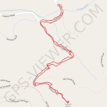
Name: Lookout Rocks GPS track, route, trail
Coordinates: 35.63882 -82.29130 35.64383 -82.28878
Other GPS tracks
Click on a GPS track to view route, its statistics and profile.
08.10.2017
United States > North Carolina > Haywood County
File with points/tracks from Locus Map Classic/3.70.9
Distance: 462.9 Km • Elevation gain: 8,858 m • Maximum elevation: 2,019 m